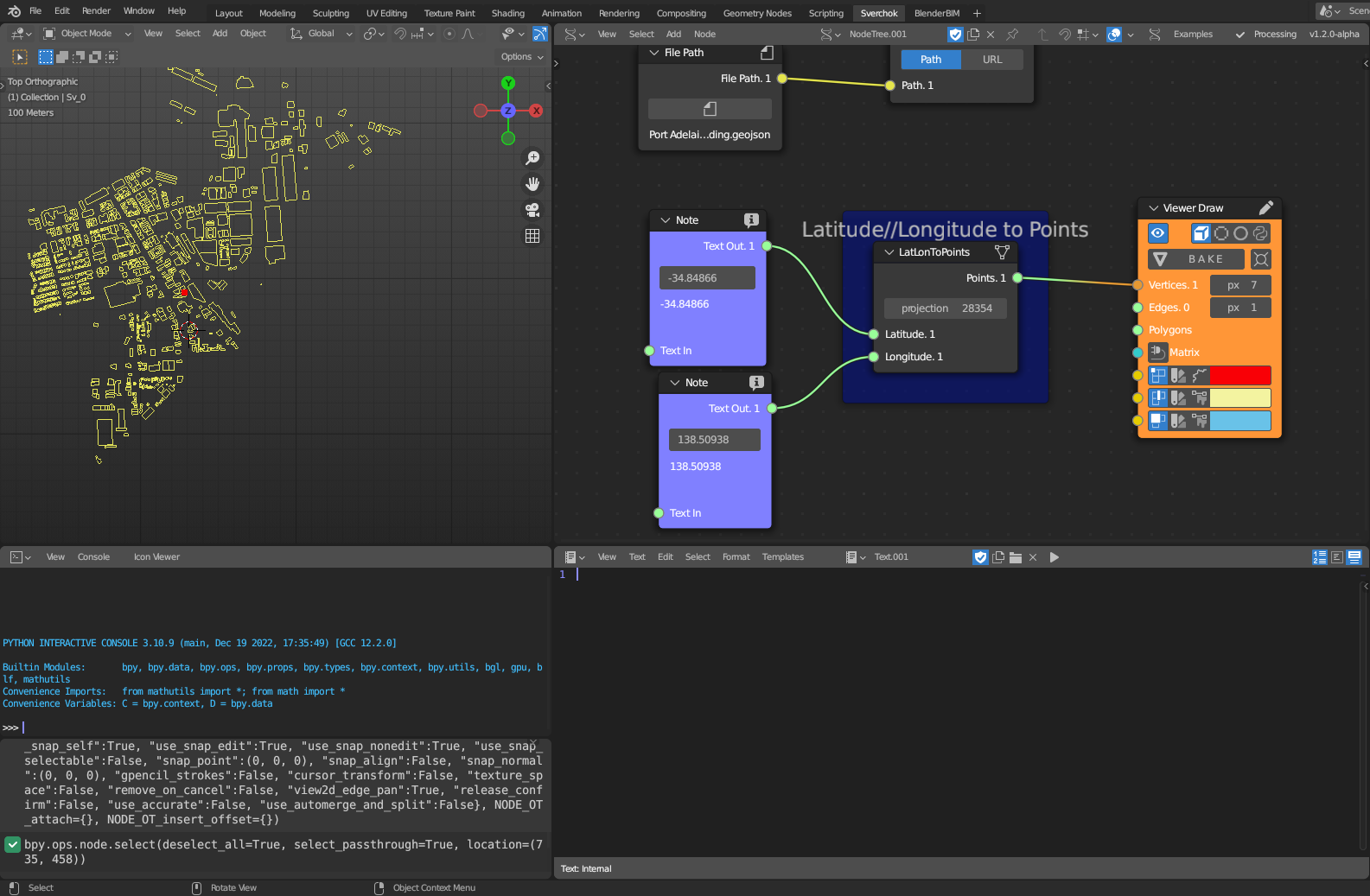
Lat/Lon To Points
Category: Mega-Polis → Generation → Generation Design Tools
Node ID:SvMegapolisLatLonToPoints
Tooltip: Lat-Lon To Points
Dependencies:pyproj(CRS, Proj, transform)
Functionality
Converts Latitude/Longitude coordinates (geographic) into projected XYZ points using pyproj.
Internally, the node: 1. Reads latitude and longitude values from the input sockets 2. Defines an input CRS as +proj=latlon 3. Defines an output projection using Proj(self.projection) 4. Transforms (lon, lat) into (x, y) using pyproj.transform 5. Outputs points as [ [x, y, 0], ... ] wrapped as [coords] for Sverchok conventions
Inputs
| Socket | Type | Description |
|---|---|---|
| Latitude | SvStringsSocket | Latitude value(s). Must be linked. |
| Longitude | SvStringsSocket | Longitude value(s). Must be linked. |
Parameters
| Name | Type | Default | Description |
|---|---|---|---|
| projection | Int | 4236 | Output CRS projection number passed to pyproj.Proj(self.projection). |
Outputs
| Socket | Type | Description |
|---|---|---|
| Points | SvStringsSocket | Projected point(s) as [[x, y, 0], ...] wrapped inside a list: [coords]. |
Example
Convert a single location to projected coordinates
- Connect:
- Latitude →
-37.8136 - Longitude →
144.9631
- Latitude →
- Set projection to a projected CRS (example for Melbourne):
32755(UTM Zone 55S)
- Output:
- Points →
[[x, y, 0]](projected meters)
- Points →
Typical workflow
- Use Point to Lat/Lon (or other sources) → feed lat/lon lists
- Convert to projected points → use points for:
- placing geometry in a projected scene
- running distance-based analyses
- exporting to GIS-friendly coordinates