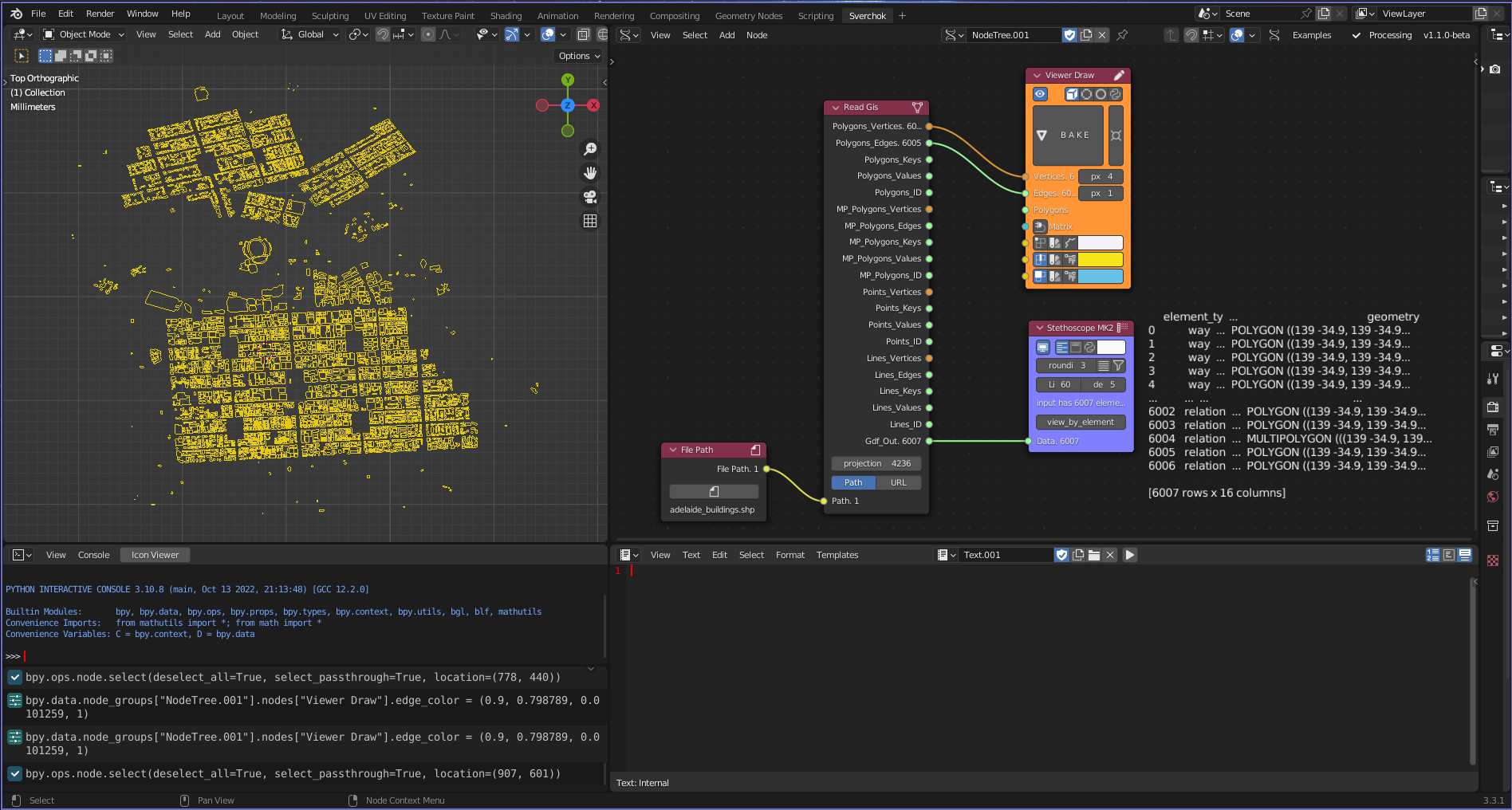
Read GIS
Category: Mega-Polis → Gathering → Gathering Design Tools
Node ID: SvMegapolisReadGis
Tooltip: Read GIS file (shapefile, geopackage, and geoJSON)
Dependencies: geopandas, osmnx, shapely
Functionality
Reads a GIS vector file using GeoPandas (gpd.read_file) from either a local Path input or a URL string input.
The node reprojects the dataset using to_crs(self.projection), then separates geometries by type (Polygon, MultiPolygon, LineString, Point) and converts them into Sverchok-compatible outputs:
- Vertices formatted as
(x, y, 0)
- Edge index pairs for topology reconstruction
- Feature attribute keys and values
- Feature IDs
- The full reprojected GeoDataFrame
Note: - MultiLineString and MultiPoint geometries are detected internally but not exported. - The projection parameter is passed directly to GeoPandas .to_crs().
Parameters
| projection |
Int |
4236 |
CRS target used in gdf.to_crs(projection) |
| filetype_gis |
Enum (Path, URL) |
Path |
Selects which input socket is active |
Outputs
Polygons
| Polygons_Vertices |
SvVerticesSocket |
Polygon vertex lists as (x, y, 0) |
| Polygons_Edges |
SvStringsSocket |
Edge index pairs forming closed rings |
| Polygons_Keys |
SvStringsSocket |
Feature property keys |
| Polygons_Values |
SvStringsSocket |
Feature property values |
| Polygons_ID |
SvStringsSocket |
Feature IDs |
MultiPolygons
| MP_Polygons_Vertices |
SvVerticesSocket |
Flattened vertex lists from multipolygon geometry |
| MP_Polygons_Edges |
SvStringsSocket |
Edge index pairs per ring |
| MP_Polygons_Keys |
SvStringsSocket |
Feature property keys |
| MP_Polygons_Values |
SvStringsSocket |
Feature property values |
| MP_Polygons_ID |
SvStringsSocket |
Feature IDs |
Points
| Points_Vertices |
SvVerticesSocket |
Point vertices formatted as (x, y, 0) |
| Points_Keys |
SvStringsSocket |
Feature property keys |
| Points_Values |
SvStringsSocket |
Feature property values |
| Points_ID |
SvStringsSocket |
Feature IDs |
Lines (LineString)
| Lines_Vertices |
SvVerticesSocket |
Polyline vertex lists as (x, y, 0) |
| Lines_Edges |
SvStringsSocket |
Edge pairs connecting consecutive vertices (open polyline) |
| Lines_Keys |
SvStringsSocket |
Feature property keys |
| Lines_Values |
SvStringsSocket |
Feature property values |
| Lines_ID |
SvStringsSocket |
Feature IDs |
GeoDataFrame
| Gdf_Out |
SvStringsSocket |
Reprojected GeoDataFrame object |
Example
Local file workflow
- Set filetype_gis to
Path.
- Connect a file path (e.g.,
buildings.gpkg, roads.geojson) to the Path socket.
- Set projection to the desired CRS (EPSG integer).
- Use:
Polygons_* for building footprintsLines_* for roadsPoints_* for POIsGdf_Out for attribute-based workflows
URL workflow
- Set filetype_gis to
URL.
- Provide a URL string readable by GeoPandas.
- Connect outputs to downstream Mega-Polis analysis or generation nodes.
Notes
- Output geometry is always 2D with Z set to 0.
- Attribute keys and values are returned per feature for downstream filtering.
- CRS conversion happens automatically using the projection parameter.